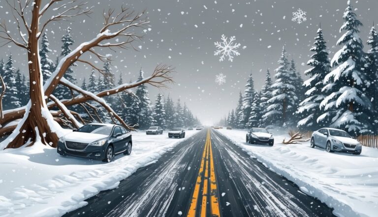
This past weekend, the central United States experienced a dramatic deterioration in road conditions as a powerful winter storm swept through the region.
This storm brought a mix of snow and ice, coupled with a sharp drop in temperatures, prompting meteorologists to warn that the hazardous weather would continue to move eastward in the following days.
Winter Weather Conditions
Bob Oravec, head forecaster at the National Weather Service in College Park, Maryland, confirmed that winter weather has firmly returned to the area.
He noted that this storm is tied to the polar vortex, a phenomenon where usual frigid air remains concentrated near the North Pole but can occasionally shift southward to North America, Europe, or Asia, leading to intense cold spells.
Studies suggest that climate change in the Arctic could be causing more frequent disturbances to the polar vortex. By Saturday evening, the forecast predicted significant snowfall across a corridor from central Kansas to Indiana, particularly in areas north of Interstate 70.
By that afternoon, parts of the interstate in Kansas had already to be closed due to hazardous driving conditions.
Some areas could accumulate an alarming total of 14 inches (35.6 centimeters) of snow and sleet in northern Missouri and Kansas. As the storm progresses, it will push into the Ohio Valley, creating substantial disruptions to travel.
It is anticipated to reach Mid-Atlantic states by Sunday and Monday, bringing a notable freeze that may even touch southern regions as far as Florida. Furthermore, the National Weather Service has cautioned residents about severe thunderstorms preceding the cold front in the Lower Mississippi Valley, potentially bringing tornadoes and hail.
Meanwhile, upstate New York is bracing for lake-effect snow, which could lead to accumulations of over three feet (0.9 meters) through late Sunday afternoon.
Impact on Travel and Safety
As the storm approached, reports of accidents started flooding in.
In the vicinity of Salina, Kansas, multiple accidents involved not just passenger vehicles but also a fire truck and several tractor-trailers.
Kansas Highway Patrol Trooper Ben Gardner shared footage showcasing the dangerous icy conditions, describing how many large trucks jackknifed or veered off into ditches. Gardner did not mince words regarding the severity of the situation, appealing for prayers and advising that many routes had become nearly impassable.
In Wichita, freezing rain contributed to numerous accidents, leading police to suggest residents remain home when possible and stay alert for emergency responders. In response to these adverse conditions, states such as Missouri and Arkansas declared states of emergency, as forecasters warned of whiteout scenarios that could make travel extremely dangerous. The effects of the winter storm were also felt in the skies, with operations at Kansas City International Airport temporarily suspended due to icy conditions.
This led to a series of flight delays and cancellations, including those for the Kansas City Chiefs.
Mayor Quinton Lucas indicated that efforts would continue overnight to improve airfield conditions.
Community Preparedness and Response
Anticipating the storm, residents in Wichita flocked to local stores to stock up on essential supplies.
Community warming centers opened in churches and libraries to assist those in need.
Many businesses in the Kansas City area opted for temporary closures, and the Independence school district in Missouri hinted at potential class cancellations that could last several days. Officials in Missouri urged people to reach their destinations before the storm settled in and suggested that travelers pack necessities for possible extended stays.
Due to a workforce shortage, road-clearing operations could face challenges, as flagged by the Missouri Department of Transportation. In Columbus, Ohio, crews were busy treating main roadways with anti-icing solutions in preparation for the oncoming storm.
Meteorologist Tom Kines warned that the combined risks from snow and ice could lead to significant power outages, especially in areas south of Kansas City. Starting Monday, forecasts predict a plunge in temperatures and biting wind chills throughout much of the eastern U.S. Meteorologists expect temperatures could fall to 12 to 25 degrees Fahrenheit (7 to 14 degrees Celsius) below normal as the Arctic vortex makes its way south. On Saturday, temperatures hovered in the teens (around -7 to -10 degrees Celsius) in Chicago and dipped around zero in Minneapolis (about -18 degrees Celsius).
International Falls, Minnesota, faced even more severe cold, dropping to 14 degrees below zero (approximately -25 degrees Celsius). In preparation for the impending storm, Virginia’s Governor Glenn Youngkin declared a state of emergency on Friday and urged citizens to participate in early voting ahead of a special election.
Similar declarations were issued in Kansas, Kentucky, Maryland, and numerous cities throughout central Illinois. Meteorologist John Gordon reassured the public that the weather situation warranted serious attention, dismissing any notions of meteorologists exaggerating the threat.
In Annapolis, residents were asked to clear emergency snow routes, and garages were opened for free parking during the storm. The National Weather Service anticipated snowfall ranging from 8 to 12 inches (approximately 20 to 30 centimeters) in the Annapolis area, with sub-freezing temperatures expected throughout the weekend.
Baltimore city authorities issued an extreme weather alert to mobilize resources for shelter and assistance to those in need.
Wind chills were predicted to dip to 13 degrees Fahrenheit (-10.56 degrees Celsius) after Saturday night and remain in the teens for several days. Furthermore, in Louisiana, efforts were underway to find a manatee spotted in Lake Pontchartrain ahead of the impending cold.
This unusual sighting during winter raised concerns about cold stress for the animal, which was first seen on New Year’s Eve.
Gabriella Harlamert, the stranding and rehabilitation coordinator for Audubon Aquarium Rescue in New Orleans, assured the public that every effort was being made to monitor and assist the animal as temperatures dropped.
Source: Insurancejournal.com


